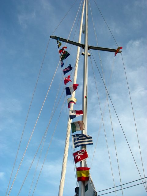
Talk to NYC U25's - Panama to Tonga and Vanuatu to Madagascar

posted by Conor &Henrietta @ 8:10 AM
![]()
![]()
A Journal of a circumnavigation aboard a Rival 38 yacht, home page at www.pamina38.com
Seeing a display of nature for the time can often be unforgettable experience. However, seeing a phenomenon when you have no idea what you are witnessing is unnerving. Describing it, having no parallels, is confounding. A few days into our Indian Ocean crossing, we saw something extraordinary with 3 nights remaining.
The passage had been terrific. We were making up for a late start from Opua in early July, and intended to cross the Indian Ocean before the cyclone season. We sailed to Vanuatu - first Tanna and then on to Port Vila. Leaving Vila on 21st July, we left our destination open, waiting to see what the conditions would bring. The first few days were fairly bumpy, winds on the beam in the 25kt range with awkward swell. We arrived at the Torres Strait at the Pandora Passage (named after the ship sent to recover the Bounty mutineers, which foundered in the straits) mid-morning on Aug 1st. The 8 hours until dusk were quite easy, as winds were light and we were sailing "fast and free". At sunset we began the SSW leg through the "Deep Water Passage” of the Torres Straits, which brought us close hauled for the next 100nm or so. The channel is well marked, and with calm seas, sailing was fast. Shortly after daybreak, we could see the large ship wrecked on Bet Reef - ironically providing great assistance to other navigators. As we passed Kircaldie reef and the wind freed-off, Henri baked a pizza and we put on some music in the cockpit. With lots of islands, reefs and even the Australian mainland in sight, we felt like we were day-sailing through the green water (10m-20m deep) of the straits. We shot through the Prince of Wales channel, and a fantastic sunset welcomed us to the Gulf of Carpentaria.
We had blustery, squally conditions in the Gulf, but fortunately we had wind aft of the beam and swells were generally not large. Speeds were good. One surprising thing about the gulf is how green the water is - even when rough - it is a turquoise colour and was a great contrast with the deep ocean blue of the Pacific. By August 6th, we were 40nm E of the longitude of Darwin, where we might have stopped, but having no need of a break, or diesel, water or other supplies we pressed on. About 500nm west of Darwin, lies the uninhabited Ashmore Reef, which we considered stopping to break the passage. In the event, we decided that what we needed was an inhabited island where we could go ashore and stretch our legs - and that meant Christmas Island, 1000nm to the W of Ashmore Reef.
Sailing was fast, pleasant and, pulled by our twin
head-sails, the miles were rolling by. During this week we recorded a
noon-noon run of 182nm (over the ground) - a record for Pamina. However the
passage would be memorable for another reason.
With 500nm to Christmas Island , we saw a very strange effect. The moon was in its 3rd quarter, and so would rise about 6 hours after sunset. As the sun went down, and my eyes began to adjust, it became clear that the sea was brighter than the sky. The guard-rails and lower rigging were faintly, but clearly, silhouetted against the sea. The entire sea was a faintly glowing green as if lit from below. It was like sailing over an illuminated swimming pool. It certainly wasn't a phosphorescence effect as it was persistent and also because the phosphorescence from our wake was barely visible against this "backlight". I called Henri up, as she had just gone off-watch. Henri, as a rule, does not like "eerie" which this definitely was. The light persisted for all of my watch. When Henri came up for her watch it was about 3 hours after sunset but the horizon was still visible because the sea was brighter and delineated against the sky. We had a quick chat about it - me from my bunk, Henri from the helm, where she asked if it changed at all in intensity (it hadn't), if the contrast in west where the sky was blackest and the sea greenest was due to the moonrise (still 3 hours away) and so on. Then she said, "it's gone", and we appeared to sail right out of the glowing water as suddenly as we had sailed into it. From that point, we then had "normal" phosphorescence until the moon came up on my watch. On the following night, not sure what to expect, and looking forward to our strange light show, we (of course) got nothing.

Some 2 weeks later, while en-route to Cocos, we saw the effect
again. It was less visible with a fainter glow and it was soon quenched by the
moon-rise. However, having now seen it twice we at least knew it was a real
effect! It would take a while to find out what we had observed. After a while
we stopped raising the subject, as we struggled to describe it and most sailors
thought we were describing a phosphorescence effect.
A description of what we had seen would have to wait for about
another year, by which time we were settling back into life in Dublin.
Bizarrely, I was watching the movie “Heat” when the De Niro character – looking out at the lights of LA draws a parallel with Fiji where they have “iridescent algae that light up the sea for miles, they come out once a year, that's what it looks like out there”. Prompted by this I spent some time searching the internet – to see what descriptions of glowing water I could find. I quickly established that the De Niro line was a bit of screen-writer hyperbole, but I found this description from a Captain Kingman, sailing South of Java (not far from where we were), in June 1854.
"The whole appearance of the ocean was like a plain covered with snow. There was scarce a cloud in the heavens, yet the sky...appeared as black as if a storm was raging. The scene was one of awful grandeur; the sea having turned to phosphorus, and the heavens being hung in blackness, and the stars going out, seemed to indicate that all nature was preparing for that last grand conflagration which we are taught to believe is to annihilate this material world."
"The entire sea surface took on an intense white glow which was not unlike viewing the negative of a photograph."from http://www.science-frontiers.com/sf086/sf086g12.htm
In fiction, Jules Verne referred to the phenomenon in his 1870 classic, Twenty Thousand Leagues under the Sea, leading to a conversation between two crew of the submarine Nautilus:
‘The 27th of January, at the entrance of the vast Bay of Bengal ... about seven o’clock in the evening, the Nautilus ... was sailing in a sea of milk ... Was it the effect of the lunar rays? No: for the moon ... was still lying hidden under the horizon ... The whole sky, though lit by the sidereal rays, seemed black by contrast with the whiteness of the waters.
“It is called a milk sea,” I explained.
“But sir, can you tell me what causes such an effect? for I suppose the water is not really turned into milk”.
“No, my boy: and the whiteness which surprises you is caused only by the presence of myriads of infusoria, a sort of luminous little worm, gelatinous and without colour, of the thickness of a hair whose length is not more than seven-thousandths of an inch. These insects adhere to one another sometimes for several leagues”. “... and you need not try to compute the number of these infusoria. You will not be able, for ships have floated on these milk seas for more than forty miles”.’
Clearly other observers have either been treated to much greater degree of light, or are blessed with greater descriptive powers.
The phenomenon is known as “milky sea” and – according to research by a Professor Herring in University of Southampton - whom we contacted and was delighted with our report - it has been observed 235 times since 1915. 171 of these observations have been in the Northern Indian Ocean and 40 off Indonesia. What once had sailors reaching for metaphysical terms, is now be explained by "free-living bioluminescent bacteria, sometimes present in such enormous numbers that they literally light up huge areas of the ocean”. An analysis of a particularly vivid event described by a merchant ship led a researcher to review satellite imagery which resulted a satellite photograph of the effect off the Horn of Africa.
I wrote to Prof Herring who, I think, was amused by the
reference to the movie “Heat” - but like I said at the beginning of the article
– its tricky to find out about something you struggle to describe, and when you
do, its hard to find someone to take it seriously! In any case, I think I'm observer
number 236!
There is a good description of the effect and some others at the following address:

posted by Conor &Henrietta @ 4:34 PM
![]()
![]()
The strange sea phenomenon we saw in the
June 1854. South of Java. Aboard the American clipper Shooting Star. Captain Kingman reporting:
"The whole appearance of the ocean was like a plain covered with snow. There was scarce a cloud in the heavens, yet the sky...appeared as black as if a storm was raging. The scene was one of awful grandeur; the sea having turned to phosphorus, and the heavens being hung in blackness, and the stars going out, seemed to indicate that all nature was preparing for that last grand conflagration which we are taught to believe is to annihilate this material world."
and
"
from http://www.science-frontiers.com/sf086/sf086g12.htm
posted by Conor &Henrietta @ 10:19 PM
![]()
![]()

Two weeks into our passage from
That evening (Sunday), Herb advised that a low pressure system was expected to form over the
Still wondering if we had done the right thing, we tuned in to Herb the following night (Monday).
“Low 995mb 40W 26N forming Tuesday afternoon, winds Tuesday pm /Wednesday am NW 45kts, winds Wednesday pm NW storm/hurricane force E of 32W, gale force E of 35W, winds 65-75kt range between Horta and Flores on Wednesday pm, system moving SE on Thursday”
We were now at 38N 38W, and so well clear of the stong winds. Amazingly, the yacht closest to us that Herb was advising (which was slightly further from Horta than us), decided to keep pushing onwards to Horta, as a Wednesday morning arrival was planned.
We waited 3 days for the system to form and begin to head east, before we resumed our course. We arrived in
posted by Conor &Henrietta @ 2:31 PM
![]()
![]()
When we left
-
-
-
Ascension was ruled-out after a few days’ sailing as we were only getting into the passage at this stage and it seemed easier to keep going. We began to have some problems with the SSB around this time, which meant poor contact with Petrel and La Familia who were doing the same passage. Winds were light, but consistent, and we were making fairly good progress towards the equator. We hit the doldrums around 2S, 34W. Light winds, one large thunderstorm during the day followed by electrical storms at night. Listening to Herb on Southbound 2, we heard that the ITCZ (aka the doldrums) extended to about 4 N. Not having enough diesel to get to 4 N, we spent a few days sailing due North in light winds changing from twin sails to cruising chute to genoa as the wind stayed light and variable. Just north of the equator, we began to get some NE winds and as we motor-sailed though the night, they got stronger. Around 1N we were getting 15kts from the NE and switched back to our course for
posted by Conor &Henrietta @ 5:02 PM
![]()
![]()

Politically,
Architecturally, Jamestown, the only town on the island, with its with many brightly painted buildings, beautifully kept public garden and old parish church is considered one of the best preserved Georgian towns.
In terms of culture, the island follows British social habits and fashions. Nevertheless there is a distinctive St Helenian look which comes from generations of intermarrying English, Portuguese, African, Chinese, Indian and Boor. The local dialect has been described as combining Dickensian English with a
These similarities unexpected and somewhat curious, if you consider that
One might have expected that the island would have close links to
We enjoyed our short stay in
posted by Conor &Henrietta @ 3:54 PM
![]()
![]()

The options for cruising boats are
- the public quay in the small craft harbour, -
- the Tuzi Gazi marina in the small craft harbour and
-
A well organised, secure, protected marina. Water but no electricity. They don’t take bookings, but the staff are helpful. There are two yacht clubs – the Point YC and the Royal Natal YC who give free membership to visitors and so make their facilities available. Both yacht clubs serve good meals, and have free internet (wifi in PYC). Durban has several good chandlers close to the marina, including some places with second hand equipment. Tony Herricks’ “Cruising Connections” has a good selection of sailing books.
Yachts raft-up at Latimers Landing which is on the north side of the
Good marina, good chandler in the town. Yachts raft-up on the nearby fishing quay when the marina is full. The marina is run by the Algoa Yacht Club, they don’t take bookings.
Mosselbaai
A busy fishing harbour with a 48 berth marina which is almost full of local boats. We got the only free marina berth. Two yachts got permission to tie-up on the fishing dock while we were there, otherwise the anchorage is supposed to have good holding. It looked rolly in the SE winds, and would be dangerous in a strong SE.
We stayed at the Royal Cape YC. Very good facilities, berths have water and electricity. Free internet in club house. Good chandlers and sailmakers (North and Quantum). Some boats stayed at the anchorage in Simonstown, others in the marina in
posted by Conor &Henrietta @ 4:33 PM
![]()
![]()
 Bazeruto to Richards Bay (10th Nov to 13th Nov)
posted by Conor &Henrietta @ 8:02 AM
![]()
![]()

posted by Conor &Henrietta @ 8:01 AM
![]()
![]()

posted by Conor &Henrietta @ 7:59 AM
![]()
![]()
We greatly enjoyed our two weeks in Chagos. Now our preparations were completed and all we needed was some decent wind before heading off for Madagascar, our last stop in the Indian Ocean before arriving in South Africa. For the last two days, the winds had been light and in the south. We always want at least a couple of days with good winds in order to get a good start. On the third day the winds filled in as forecast and we were off on Friday 29 September.
We left the anchorage off Takamaka Island and sailed quickly across the atoll for the pass. While I was standing on the bow as a look-out to check for coral, Henrietta put out the fishing-line. Before we got to the pass we hooked and landed a large trevally. About an hour later as we sailed south along the outer edge of the atoll, past the Saloman Islands, we caught a yellow-fin tuna. This gave us a great start on fishing and meant we could take in the line for a day or two. For simplicity's sake, our gear is basic, and not very "sporting", it invariably consists of a hand-line with 150kg nylon monofilament, a rubber-squid lure and a large double hook.
A good start to the fishing then, but the first evening proved not so good for the sailing. Rather than the anticipated 15-20kts from the SE, by the evening the wind dropped to 10kts from the SE and first night was full of squalls. While the wind never went over 20kts, the wind direction was continuously changing, there was lots of rain and additionally the "holes" behind the squalls were hard to avoid. Progress was slow, so that in the first 24 hours we ended-up motoring for 6 hours and only made good about 100nm.
Our slow start was in stark contrast to the friends we spoke to that first evening - they had left 5 days before us in their Swan 46 and had made good over 1000nm in that time, with a best day run of 220nm, a rate we could only dream of! They gave us some good advice on threading though the large system of banks known as Saya de Malha on the direct route from Chagos to Cap Ambre, the northern most point of Madagascar. They had taken the narrow northern pass and described a period of 6 hours where the seas were dangerous with the top 2m of the swell breaking heavily. This confirmed our intended strategy of heading for the southern pass through the banks at 12 S, which adds about 50nm to the 1600nm passage.
In the late morning of the second day, the wind filled-in from the SE, 15-20kts, and we were happy to be reaching in the trade-winds on a course of about 240T. For the next three days, we clocked up daily runs of over 165nm as the wind rose slightly to 20-25kts. Comfortable sailing, if a little wet as the swell was now breaking slightly and getting blown in to the cockpit. We looked forward to getting to 12S and turning west, after which we should be just as fast, drier and might even be able to get the twin headsails up. The twin headsails are our favourite set-up: they are comfortable, easy to manage and can usually be relied on to keep the speed up, if the trade winds are blowing.
On Day 6 we had run 850nm from Chagos. We had reached 12S which is approximately the latitude of Cap d'Ambre, now 675 to the West of us. The winds were too far in the south to set the twin-jibs, which can usually be set at 135 degrees to the wind angle. We now had the South Equatorial Current behind us giving us another knot, so we continued to make good progress. The weather was pleasant. We had enjoyed clear skies with no squalls since the first evening. The days passed quickly, as we occupied ourselves with the daily routines of a long passage: fishing, preparing meals, keeping in touch with friends via a radio net and with family via onboard email, and getting weather fax and "grib" files. The moon was almost full and we looked forward to a few enjoyable nights as we approached the Cape.
Cape d'Ambre, as described in the cruising guides and pilot, is a windy place with potentially heavy seas. A north flowing current runs on the western side of Madagascar and meets the South Equatorial Current in an area of over-falls to the north of the cape. The advice from East Africa Pilot is to stay a few hundred yards off the coast to miss the overfalls. In Chagos, we were been given similar directions from skippers who had previously done the crossing.
During days 7, 8 and 9 it looked increasing likely that we would approach the Cape during the night - not desirable as we wanted to pass close to the shore. Our policy of avoiding unnecessary risk by not approaching land or entering harbours at night meant that on three of our four passages since New Zealand we have had to slow down to make daylight arrivals. We have found this surprisingly hard to do, sailing with reduced canvas is rolly in the ocean swell and heaving-too is equally rolly unless there is quite a lot of wind. On the evening of day 10 we were less than 70nm from the cape having continued our average daily runs of 150nm. In order to round at first light, we decided to keep our speed below 5kts and heave-too as we got closer to the shore. We anticipated a slightly uncomfortable night, but as we were only 50nm from the cape, we should be able to round at first light.
Henrietta went down for her off-watch at 8pm. I kept the boat going at 4-5kts, reducing sail as the wind rose. During the next three hours, the wind clocked to the SSE and began to rise rapidly from 20kts to 40kts as we got within 40 nm of the cape. Initially I put the wind rise down to an acceleration effect around the headland, but when the next weather fax came through, the gradient wind was showing 40kts which was not shown on earlier forecasts. We knew then that we were in for a rough night.
At the same time, wind and current became more parallel to the coast as we approached land. I altered course to the SW to try and offset the effects of these, bringing us onto a close reach. By the end of my watch at 11pm, we were getting 40kts of wind over the deck, but the seas were neither steep nor breaking. I did not want to heaving-too as we would rapidly find ourselves north of the cape in the region of the overfalls. We discussed what we should do for Henrietta's watch, and decided to hold our SW course for as long as we could, then tack to the east and return westwards in the morning to round the headland close to shore in daylight.
I took half a Stugeron and went to sleep. One hour into her watch, Henrietta called me up. The wind now was now well over 40kts and occasionally reaching 50kts - some of the strongest winds we had experienced so far on our circumnavigation. We could barely hear each other as we shouted across the cockpit - only feet apart. The sea-state had deteriorated considerably during the last hour. Close to the coast, the shore shelves steeply: there is only about 5 miles between the 200m contour and the 1000nm contour. We were just within the 1000m contour and approaching the 200m contour. It was clear that we had to get back into deeper water in order to avoid the worst seas. We tacked back to the east and within an hour, the sea state improved.
By my next watch at 3am, the winds came back to below 40kts. We had been sailing all night with heavily reefed main (an in-mast furling system) and roller-reefed jib. The main works well when heavily reefed as it acts almost like a tri-sail. The jib, however, is not so efficient when reefed down as even with the genoa car all the way forward, the leech is too loose. In order to improve on our sail configuration, we decided to set the storm-jib. To set the storm-jiib, we would first need to rig the inner forestay and reposition the dinghy which is strapped down on the foredeck during passage. Given the conditions, we decided to delay this work on deck until after day break.
Once the sun rose, we repositioned the dinghy, rigged the stay and hanked on the storm-jib. This went smoothly, until a wave broke over the front of the boat and sent me sliding down the deck. As I lost my footing, I let go of the sheet I was holding and the bitter end shot overboard. When I tried to pull the sheet back, I found it was stuck. The sheet had wrapped on the freewheeling prop. I called out to Henrietta who was still on deck, struggling with her lifejacket which had inflated in the same wave. This was not what we needed! I quickly got a line rolling hitched onto the sheet and brought it back to a winch and tried to see if it would unwind. No luck, but at least it couldn't get any tighter. We've never fouled on our lines before, but ropes have got caught on our propeller twice before, while motoring in the Mediterranean. On those occasions in calm seas I went over the side with a knife. This time I left Henrietta (who had struggled free of the inflated life jacket and was wearing a spare) on the winch and went below to try and twist back the shaft by gripping it between the gearbox and the stern gland. As we couldn't communicate any longer, Henrietta would keep the line hitched to the sheet under tension and take up slack if any was made. It felt like a long shot, as I leaned into the locker and tried to get a grip on the shaft. We were fortunate, it needed three or four complete turns and the sheet was free. We could hardly believe our luck. Now we could concentrate on getting the storm sail set and getting around the cape.
The storm sail improved the speed, trim and heel of the boat. Even though Pamina was launched in 1990 and we have sailed over 20,000nm since 2003, this was the first time the sail was used. Since the sail is rigged on an inner stay, the sheeting angle is much improved. The shape of the sail is far better than the roller sail. In addition the weight of the cloth is much heavier and of course the sail is pristine. We would have put it up earlier, but were reluctant to set the stay during the night.
We had tacked and were now heading westwards at over 6kts close hauled, making good speed towards the cape. I decided to stay outside the 1000nm contour and run the risk of hitting the overfalls, since we knew the sea-state in shallower water was likely to be dangerous by now. We eventually rounded with an offing of about 10nm, instead of the recommended 100 yards and saw no deterioration in the sea state. The wind backed as we cleared the cape and we were able to get more south into our course. It is possible to double a headland and see no noticeable effects on either side, not with Cap D'Ambre! Soon after rounding we were getting a lee from the headland and we were occasionally hitting 8kts in calm seas - under storm jib only. Some 10nm south of the headland the wind eased and we were happy to slow down as it was now dark. We were only 30 or so miles from our intended anchorage at Nosy Mitsio.
The next morning (10 October) we sailed into Maribe Bay on the western side of Nosy Mitsio, and anchored in 6 meters depth opposite a beautiful golden beach. The calm anchorage, clear green waters and the near deserted beach provided a good spot for us to rest after the activity of the last 24 hrs. We were joined later that afternoon by Chris and Julie on the Swan who sailed from Nosy Be to meet us and looked after us very well by providing fresh produce, delicious dinners, great company over the next few days.
---------
posted by Conor &Henrietta @ 12:01 PM
![]()
![]()
We arrived in Chagos on 16 September, after a pleasant if slow passage from Cocos Keeling. Due to the light winds preceding our arrival we missed Eagle Wing and Petrel whom we had been 'chasing' since leaving NZ by only a few days. They had stayed 6 weeks in the atoll and delayed their departure to meet up with us, but left for Madagascar in a good weather window before our arrival.
Chagos is an island group that marks the middle of our Indian Ocean passage. The group is a British Indian Ocean Territory, whose indigenous population was re-located. Part of the island group is now leased to the US who maintain a large base on Diego Garcia, in the south of the group and the rest of the group is administered by a British representative located at the base. Diego Garcia is off-limits for yachts, even in a genuine emergency yachts are discouraged from approaching the base (assistance will be "considered").
Chagos is famous amongst sailors as being home to a semi-permanent community of cruisers. Its location 5 degrees from the equator means that the island group is effectively not at risk from cyclones so that visiting yachts need not leave at the end of the sailing season to seek shelter elsewhere. Several yachts have stayed up to several years here, leaving the islands only for provisioning trips to the Maldives, the Seychelles or Madagascar.
Chagos also has the reputation of being a desert island paradise, a place where sailors can live without the constraints and rules of the modern world. Of course there are some rules - regarding the duration of stay, prohibitions on spending nights ashore and regarding the erection of permanent structures on-shore, and also strict conservation rules (such as not hunting coconut crab nor spear fishing within the lagoon).
The sailors who live here regard the islands as their village and spend some effort looking after the island. On first coming ashore and expecting a natural environment, it is therefore bizarre to see the dirt paths neatly swept and bordered by small sprouting coconuts. Some of the ruins on the islands have been adapted to the needs of the visiting yachts. There is now a 'yacht-club': a tin-roofed shed with rusty garden chairs and round table fashioned from drift wood, a make-shift fish cleaning table and bbq pit with 'library' facilities (a basket of books), beach games and a volley ball net. In addition, there is a well which is used for laundry beside which the old copra warehouse, its roof intact, is now used to gather rain-water into large tanks and for drying clothes.
The long-termers are a sociable gang, not hermits seeking isolation as the image of a desert island paradise might suggest. In fact, the community of long-termers is quite active and their social calendar is like any other ex-pat community's - during the height of the season there are swap meets (boat jumble sales), home-made wine tasting sessions, regular pot-luck dinners, music sessions and even themed fancy dress parties.
In the week preceding our arrival, most of the cruising yachts had moved on as it was approaching the end of the season. This meant that we had Chagos almost to ourselves, a rare occurrence as it can be busy at the height of the season with up to 60 yachts spread across the two anchorages. At the time of our arrival, three boats of the six boats at anchor were long-termers. The others, including ourselves and our friends on Cisnecito, were passing through. One long-term yacht, "Lady Guinevere", had only just returned from a provisioning trip to Male (Maldives) and would be spending the next 18 months in Chagos. Their provisions included 50kg of gas for cooking (most of their cooking and baking is done ashore using wood/coconut husks), an amazing 500 litres of petrol for the outboard engine for fishing, 100 kilos of sugar for the distilling of rice wine and seeds of spinach, peppers and cress for their on-deck vegetable garden.
We spent the first few days anchored in the "pass" between Takamaka and Fouquet, beautiful turquoise waters, sheltered from the trade wind swell, but with a nice breeze. Ashore, Takamaka Island shows some signs of habitation, with an old well and the foundations of some houses visible. We then moved down to Boddam Island, the originally inhabited island which has many ruins, incl. a church, a jail, a graveyard, the copra warehouse, and several private houses. The buildings are so completely overgrown with tropical vegetation and trees that it is amazing to think it is only 40 years since people lived here. As Julie said, "It is very 'Lost'!" and any moment we were expecting the strange French woman to appear or an aeroplane to be found.
While we were at Chagos, the BIOT officials came to clear us in. Whilst we had hoped to escape a charge of $100US (the fee for up to three months), it was interesting meeting the friendly and relaxed officials. They consisted of a group of British soldiers from Yorkshire in T-shirts and without any sun protection (very much Best of British squadies abroad), and the newly appointed Governor of the BIOT sporting a large hat and covered head-to-toe in light weight clothes and sun block (very much 'our man from the FO'). The marines travel between Diego and the other atolls on a former rig-support vessel known as "Pacific Marlin" which is also used for fishery patrols. The crew of the Marlin usually spend Sundays on Boddam Island for the crew's day-off. We were lucky to meet them there and spent a pleasant afternoon chatting to the crew (Scottish captain, South African engineer and mainly Bangladeshi crew), drinking their ice-cold beers and watching them play volleyball. At the end of the afternoon, one crew came up to Henri and said in fluent Greek "Why didn't you tell me you were Greek? I've worked on Greek ships for 15 years"!
Most days we went swimming and snorkelling, caught up on boat jobs and laundry, relaxed with a book and generally had a great time hanging out with Julie and Chris. Once or twice Conor went fishing in the lagoon with Chris and caught rock cod and trevally which we bbq-ed ashore. Another day, the four of us smoked some bonito, trevally and an enormous yellow-fin tuna head. It took four hours to smoke the head and two for the fillets and the taste was fantastic. The snorkelling inside the lagoon is good but not as spectacular as Cocos Keeling. We once snorkelled outside the atoll, from the back of Boddam Island and saw the atoll "wall" dropping-off to ocean depths and another time snorkelled on the wreck of a yacht, wrecked on the coral only half-mile from our anchorage. The two weeks we spent at Chagos were very enjoyable: each day was a perfect holiday and most days ended with either sundowners or a bbq ashore. After Chris and Julie left, we spent three days at anchor on our own and enjoyed the perfect, desert island lifestyle for a few days.
Whilst Chagos is very beautiful and although we enjoyed our stay, we couldn't see ourselves staying here for months - let alone years. There is simply not enough variety to keep us interested for long. And so after two weeks, we were ready to set sail and left Chagos on 29 September headed for Madagascar, the 'wild card' in our Indian Ocean Passage of which we knew little.
----------
radio email processed by SailMail
for information see: http://www.sailmail.com
posted by Conor &Henrietta @ 1:38 PM
![]()
![]()
